
Why climb the highest point in Idaho?
Something about getting to a place that’s ‘exclusive’
Something about challenging myself to achieve a goal
Something about trying something new
Perhaps all the above are why I decided to try.
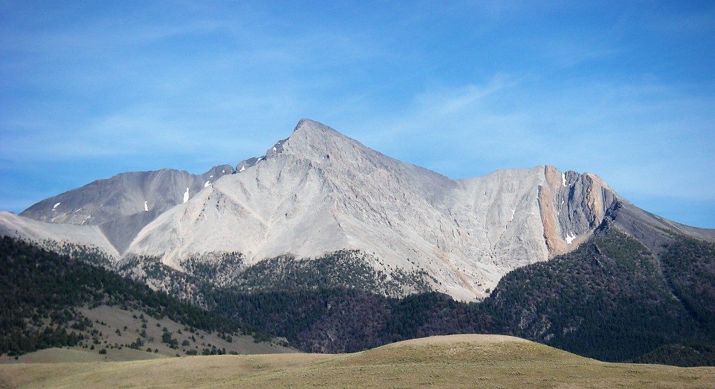
Mt. Borah
Elevation: 12,662 feet
Climbing this mountain was something I had been wanting to experience for quite some time. 2018 came and passed without making any attempt and as 2019 progressed I knew I had a short period of time left or else another opportunity would be missed.
Within a day, my friend Rob and I decided there was one last weekend of good weather left before the it began to freeze & snow on the mountain. We booked what was advertised as a hotel (more or less), gathered last minute equipment and planned to begin our trip after a Friday workday.
Mt. Borah itself isn’t near any large cities or towns. In fact, the closest towns are about 45 minutes away from where the hike begins. We settled on staying in a cheap motel in Challis Idaho which neither of us knew existed up till this point. It took us roughly four hours but we arrived to the motel Friday night. It was early to bed as we planned on waking up and hitting the trailhead around 6 AM the following morning.
September 14th, 2019
HIKING DAY
Our alarms went off at 5 AM. Neither of us felt tired, we packed our gear, filled up as much water as we could and loaded the car.
To gather a sense about the motel we were staying at, as we were walking out the door there was a guy sitting outside who appeared to be coming off some drug induced bender… Needless to say we didn’t leave anything valuable in the room before leaving.
Just after 6 AM we arrived at the parking area at the base of the trailhead which sits at about 7,400 feet in elevation. We were shocked to see just how many other people were already there who had either already begun hiking or were making final preparations to set off.
The sky was still black, all we could really see was the dark silhouette of the mountain range in front of us which was exposed by the moon’s light. At 6:30 AM we began our hike.
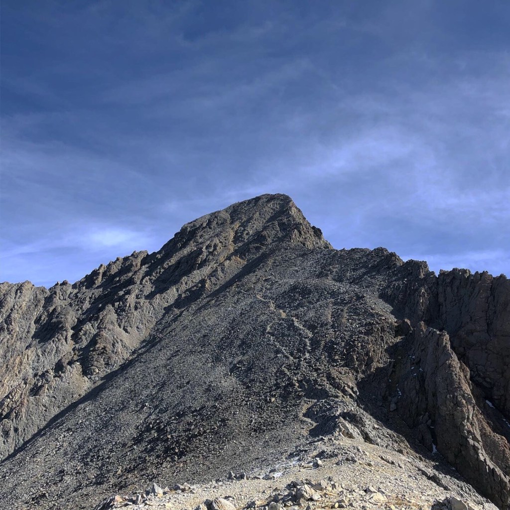
Two hours in; We had broken the initial tree line and what seemed like endless switchbacks. The sun had risen along with the temperature. We could look back and see the ground we’ve covered, the cars were no longer in sight and the trail was quickly becoming a rocky slope. More importantly, for the first time we could see the peak of Mt. Borah in the distance.
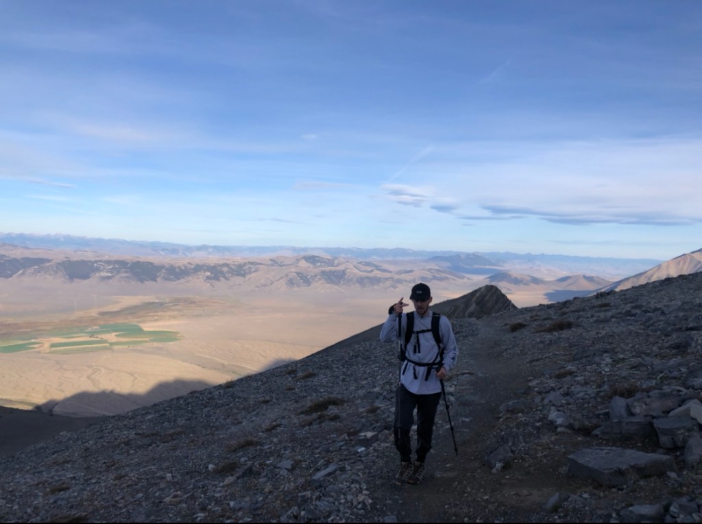
There were numerous groups of hikers scattered along the trail ahead and behind us which definitely helped ensure we stayed on course. It was about halfway up we got to the infamous ‘Chicken Out Ridge’ that everyone tends to be wary of. I didn’t find it as intimidating like some made it out to be. Essentially you are climbing along a rocky ridge with drop-offs on either side.. ( as I’m typing this I realize that still sounds intimidating) but the foot & hand holds are secure and as long as you take your time it shouldn’t be an issue.
check out the video at the end to see us climbing this section
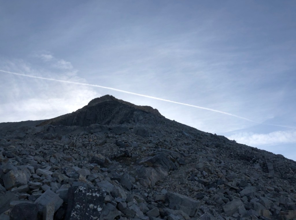
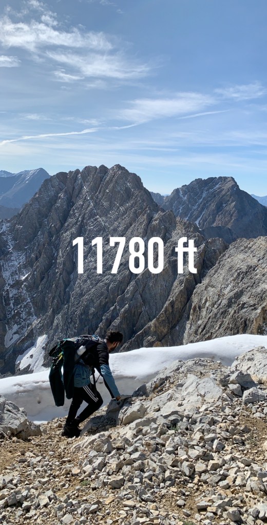
Four hours in; We had crossed the ridge line, passed the snow bridge (which was more or less a rocky trail this late in the season) and were met with the final ascent up to the summit. At this point we had climbed to over 11,700 feet in elevation. The end was clearly in sight and all that stood between us was a steep 1,000 foot trail covered in loose dirt & rocks.
This final climb was definitely the hardest part up till this point. Not only is the altitude a factor, but after hours of climbing this final steep section was unwelcoming to say the least. Both Rob and I thoroughly despised it but knew this was the final stretch to the summit.
12:00 PM; SUMMIT.
We had done it. A total of 5.5 hours later, we finally stood atop the infamous Mt. Borah. I don’t know what felt better; Not having to go up what seemed to be an endless incline or having finally achieved our goal.
**SPOILER**
It was the part about achieving our goal.
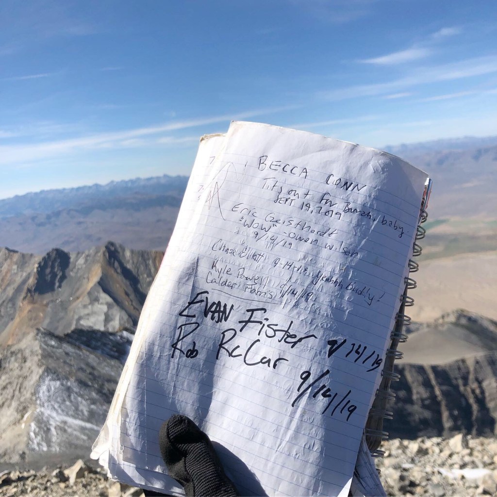
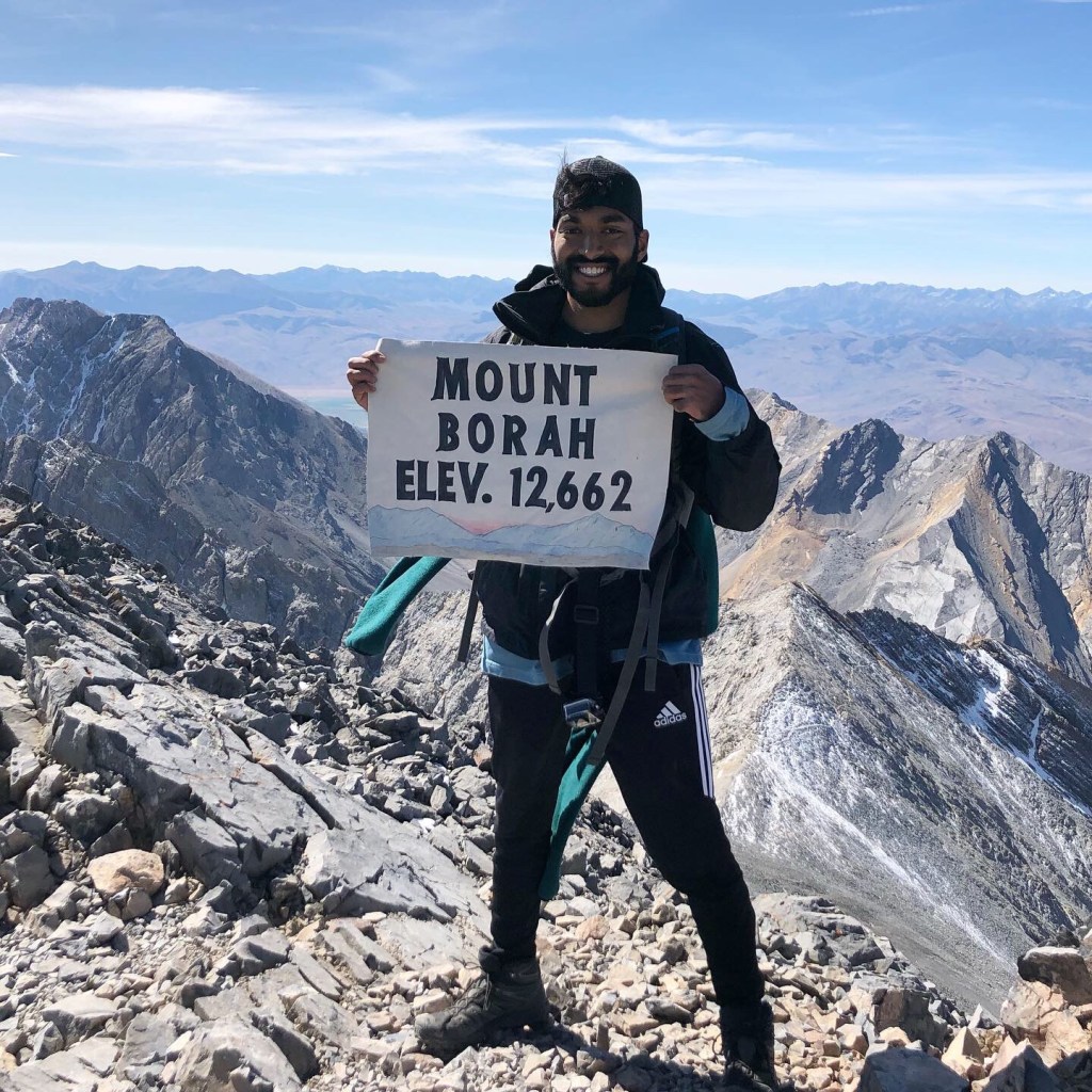
Much to our surprise there were about fifteen or so other hikers taking in the view at the summit. There was a geocache with a notebook for you to write your name in, as well as a summit banner for those celebratory pictures (see below).

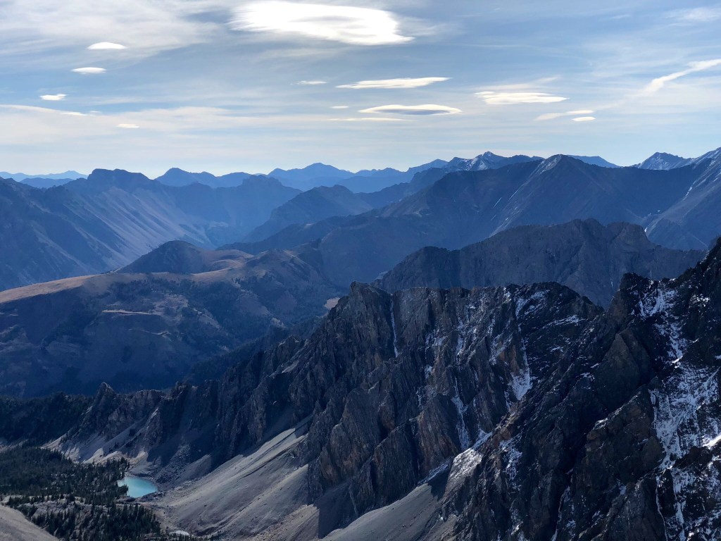
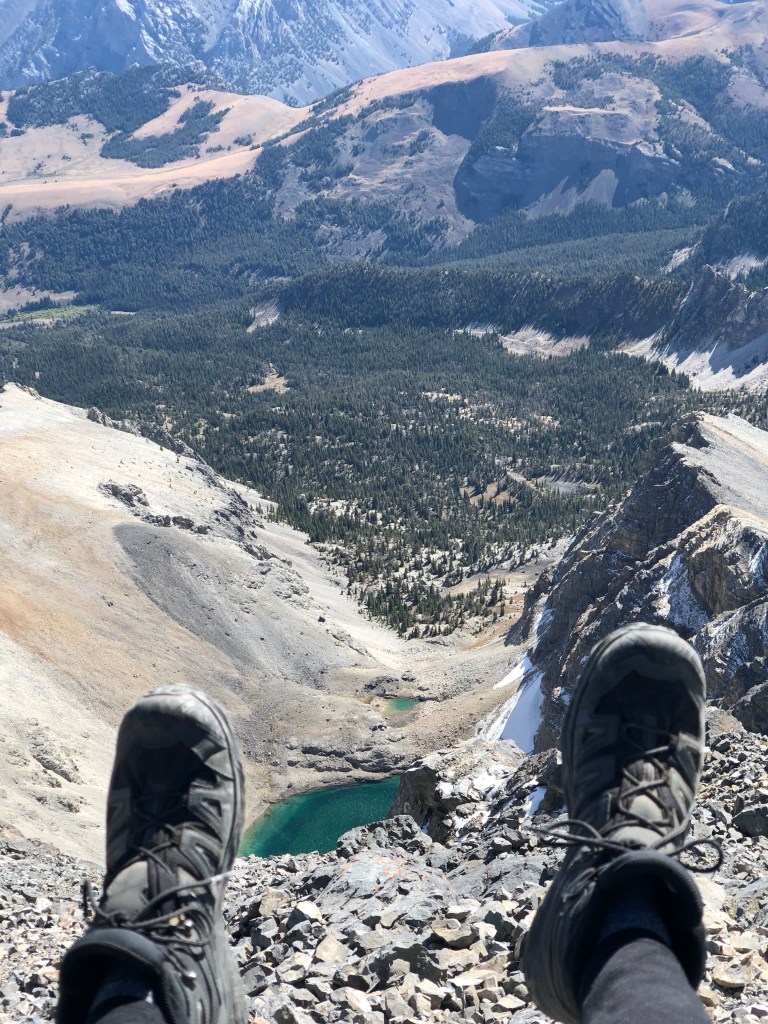
Looking back down the mountain we gathered a sense of what we really just accomplished. The trail we had just hiked stretched on for miles along a sweeping mountain ridge. Looking out over the horizon, we could see the entire Lost River Range expanding out of sight. Down below us several thousand feet was a bright blue pond that was so clear you could see right through to the bottom.
I had brought my drone up to the top and had been waiting to use it just for this moment. Much to my displeasure, due to either the strong winds or magnetic interference, the minute I took off severe instability ensued forcing me to land with no real chance of droning. Talk about a bummer.
We spent the better part of an hour up at the summit, talking with others, taking pictures, and just taking in the view. From guides we had read, others advised that the trek back down takes just as long as going up so we knew it was best to get going back down.
The first few hours we steadily climbed back and over Chicken Out Ridge and were making our way down the rocky mountainside. We saw a group of mountain goats just off of the trail who vanished off the mountain side as we went by them.
When we started nearing the treeline again is when the physical toll started to take effect. The steep decent had taken its toll on my knees and it felt like a combination of burning & aching which definitely slowed me down. Rob and I meandered back through the treeline for what felt like an eternity. Neither of us recall that portion of the hike taking that long just several hours earlier.
Just before 6:00 PM we made it back to the trailhead, where at this point we both rapidly proceeded to strip off our boots & gear and down copious amounts drinks we had left in the car. It had been almost exactly 12 hours since we left the car and in that time we had climbed a total of 7.3 miles with an elevation gain of 5,250 feet out and back.
It didn’t start to sink in until we began driving back to the main road of what we just achieved. I recall very vividly looking at Rob and saying,
WE JUST *insert profanity* DID THAT!
-Evan after hiking Mt. Borah
This was something that I was glad to cross off my list. Nothing compares to the feeling of setting a goal and going out and doing it. Would I do it again? Definitely.
THE END.
CHECK OUT THIS VIDEO FOR THE FULL EXPERIENCE:
